High-Resolution Orthophoto & Mosaic Mapping Services
GIS Mappers provides precision orthophoto and mosaic mapping services using high-resolution drones for a wide range of surveying, urban planning, environmental monitoring, and infrastructure projects.
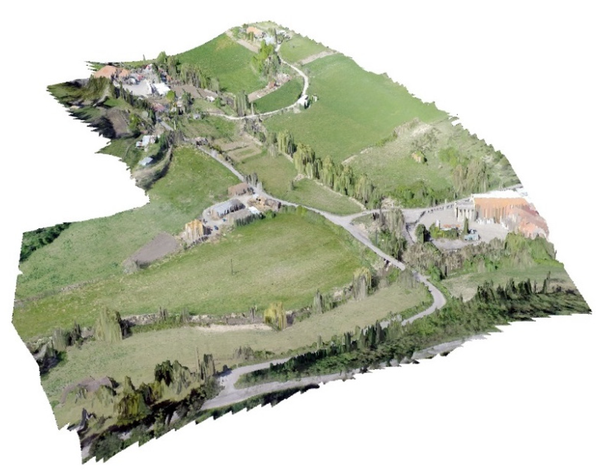
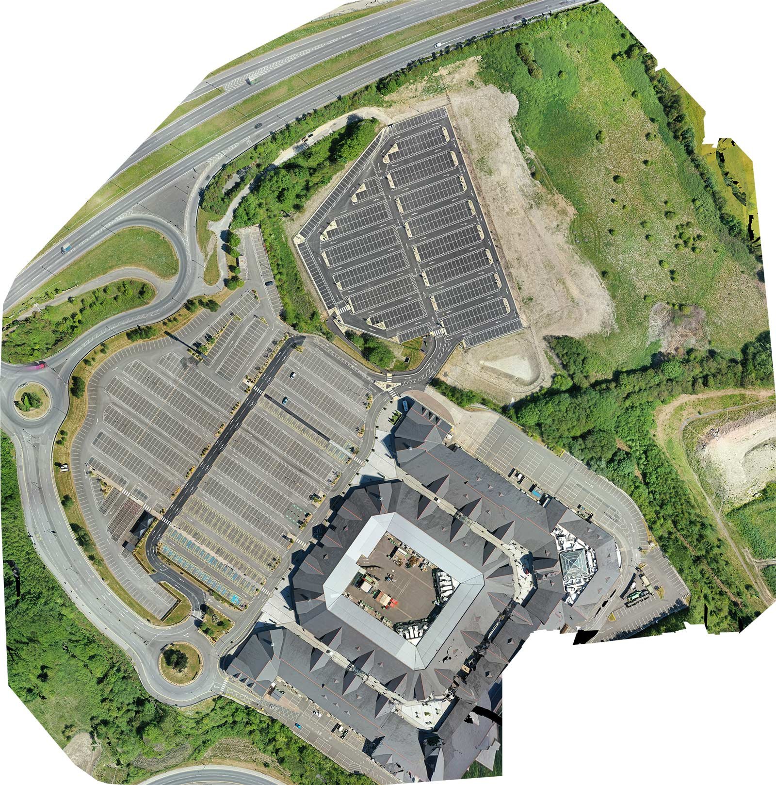
Our drone-captured orthophotos are georeferenced, distortion-free aerial images created using advanced photogrammetry. These accurate visual records are ideal for GIS analysis, land use planning, construction monitoring, and asset inventory mapping.
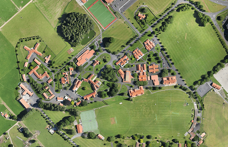

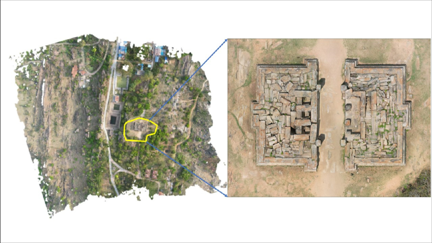
We deliver scalable orthophoto outputs that cover large areas at 2–5 cm/pixel resolution, integrated with GPS coordinates and matched to site-specific control points (RTK/PPK).
The final deliverables include georeferenced orthomosaics (GeoTIFF, JPEG, KMZ), along with optional elevation models and contour overlays for planning and design applications.
Benefits of Drone-Based Orthophoto & Mosaic Mapping
- High-Resolution Aerial Imagery: Ideal for infrastructure monitoring, planning, and documentation.
- Accurate Georeferencing: Integrated with survey-grade GNSS data (RTK/PPK).
- Rapid Area Coverage: Map large areas in a single flight session.
- Time & Cost-Efficient: No need for traditional field surveys.
- GIS & CAD Compatible: Delivered in standard mapping formats.
- Consistent Visual Records: Supports repeat surveys for change detection.
Applications of Orthophoto & Mosaic Mapping
- Urban & Rural Planning: Zoning analysis, site selection, and infrastructure layouts.
- Construction Progress Monitoring: Track development phases with time-stamped orthomosaics.
- Environmental Impact Studies: Baseline and post-impact mapping.
- Disaster Management: Rapid assessment of flood, landslide, and earthquake zones.
- Agricultural Surveys: Crop health analysis and land boundary verification.
- Asset Management: Map roads, pipelines, utilities, and facilities with geotagged imagery.
Let GIS Mappers support your next survey or infrastructure project with precision orthophoto & mosaic mapping services for accurate site visualization and informed decision-making.